Pyrenean travel agency specializing in hikes in the Pyrenees, Basque country and the GR10.
BASQUE COUNTRY: Maison IPUTXAINIA, 64220 ASCARAT
ARIEGE: 20 chemin de la montagne, 09000 FOIX
+33 (0)5 34 14 51 50 - +33 (0)6 10 97 16 54
Select your language

")
")
{pdfviewer file=https://respyrenees.com/media/attachments/2023/03/06/respyrenees_brochure_definitive_2023_bd.pdf}
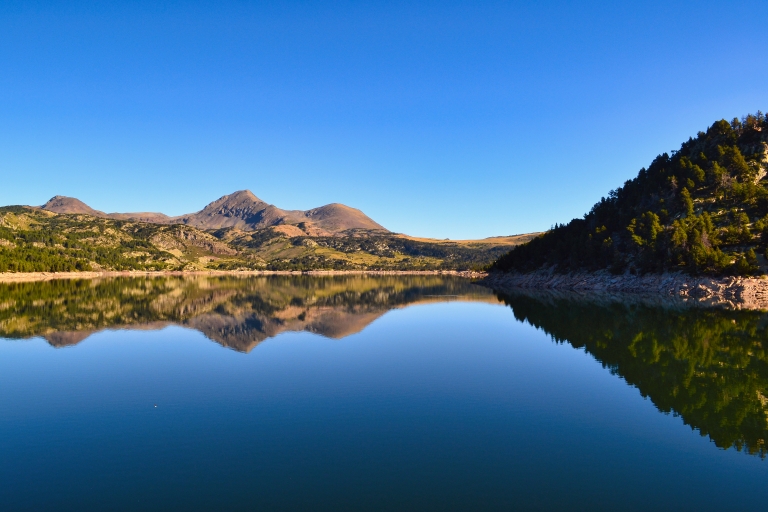
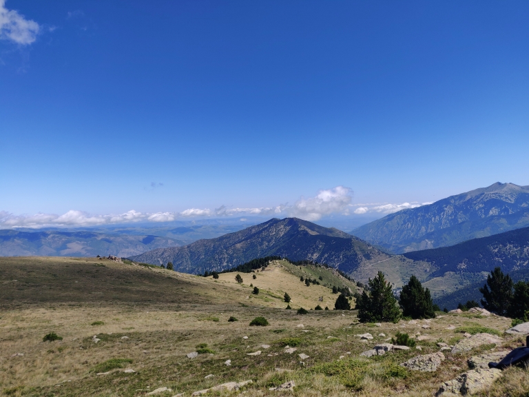
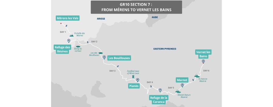
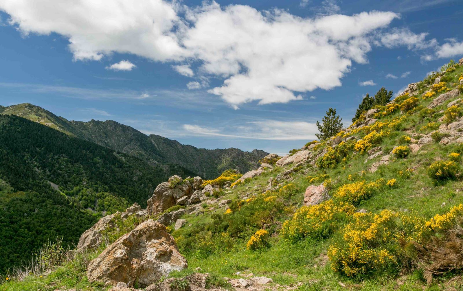
This 7th section of the Pyrenees Crossing, with the famous GR10 as its guiding thread, leaves the Ariège region to enter the Eastern Pyrenees, renowned for its sunny high-altitude plateaus. Starting from Mérens-les-Vals, you will reach the Bésines Refuge before embarking on a beautiful mountain stage with stunning lakes surrounding Puig Carlit, the majestic peak of the area, rising to 2,921 meters.
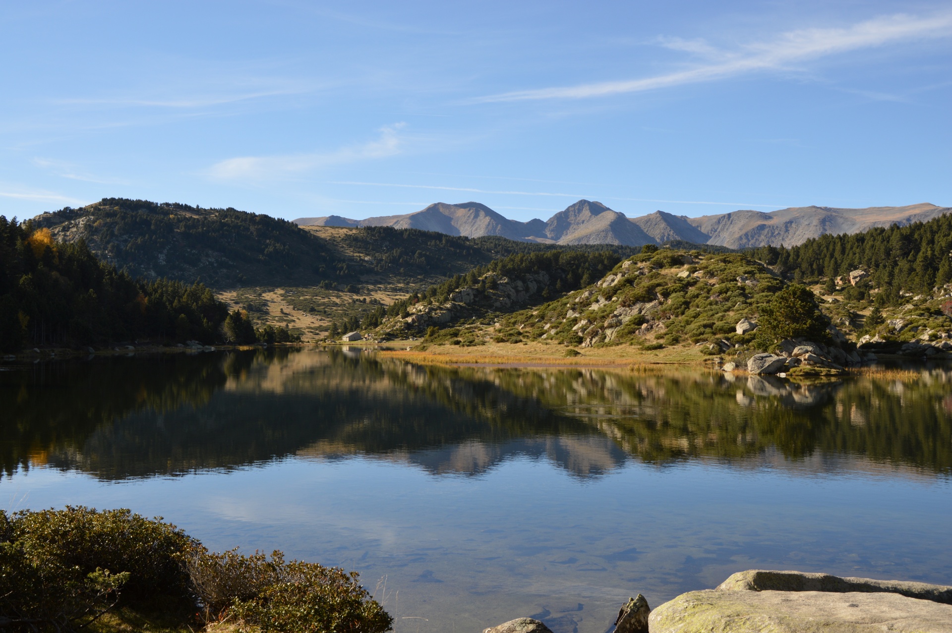
You will then arrive at the Bouillouses Lake, surrounded by numerous other lakes nestled in breathtaking landscapes of mountain pines and high-altitude meadows. The journey continues across the vast Cerdagne plateau in the heart of the Catalan Pyrenees Natural Park, featuring picturesque mountain villages and the spectacular Yellow Train that crosses the region.
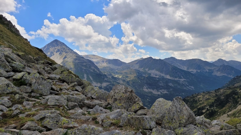
Leaving the Cerdan plateau, the route gradually leads you to the Conflent region, where the landscapes take on an increasingly Mediterranean character. After a stop at the charming Carança Refuge, set in the heart of a beautiful valley, you will explore the Mantet and Py Nature Reserves. Close to Catalonia, Spain, these reserves are marked by high, desert-like plateaus reminiscent of the Andean altiplanos, rising towards the renowned Pic du Canigou. This iconic peak overlooks the spa town of Vernet-les-Bains, the final destination of your journey.
Guaranteed departure with a minimum of 4 participants.
Price: €995 per person
Supplements:
- Return transfer from Villefranche-de-Conflent to Mérens-les-Vals: €90 per person
- Additional night in Mérens and/or Vernet-les-Bains: Contact us for details
- Full-board accommodation from the Day 1 picnic to breakfast on Day 7
- Luggage transport between accommodations, except for 2 nights in mountain huts (Days 1 and 4)
- Transfers mentioned in the program
- Supervision by a certified mountain guide (BE AMM) specialized in the region
- Insurance
- Transfers not included in the program
- Entrance fees for visits
- €15 booking fee
- Beverages
Day 1: From Mérens-les-Vals to Bésines Refuge
 Meet
your guide at 9 AM in Mérens-les-Vals at the starting point of the
hike. From Mérens, you will gradually leave Haute-Ariège and head
towards Capcir, with a classic Pyrenean stage
featuring deep valleys and a mountain pass. A long ascent along
the Nabre valley and stream will lead you to the
Porteille des Bésines at 2,333 meters above sea
level. You will then descend towards the Etang des Bésines
and its staffed refuge. From the refuge terrace, the view
of the lake and the nearby Pic Pédros is
stunning.
Meet
your guide at 9 AM in Mérens-les-Vals at the starting point of the
hike. From Mérens, you will gradually leave Haute-Ariège and head
towards Capcir, with a classic Pyrenean stage
featuring deep valleys and a mountain pass. A long ascent along
the Nabre valley and stream will lead you to the
Porteille des Bésines at 2,333 meters above sea
level. You will then descend towards the Etang des Bésines
and its staffed refuge. From the refuge terrace, the view
of the lake and the nearby Pic Pédros is
stunning.
Distance: 9 km, duration: 4h45, ascent: +1300 m, descent: -300
m
Day 2: From Bésines Refuge to Bouillouses Lake
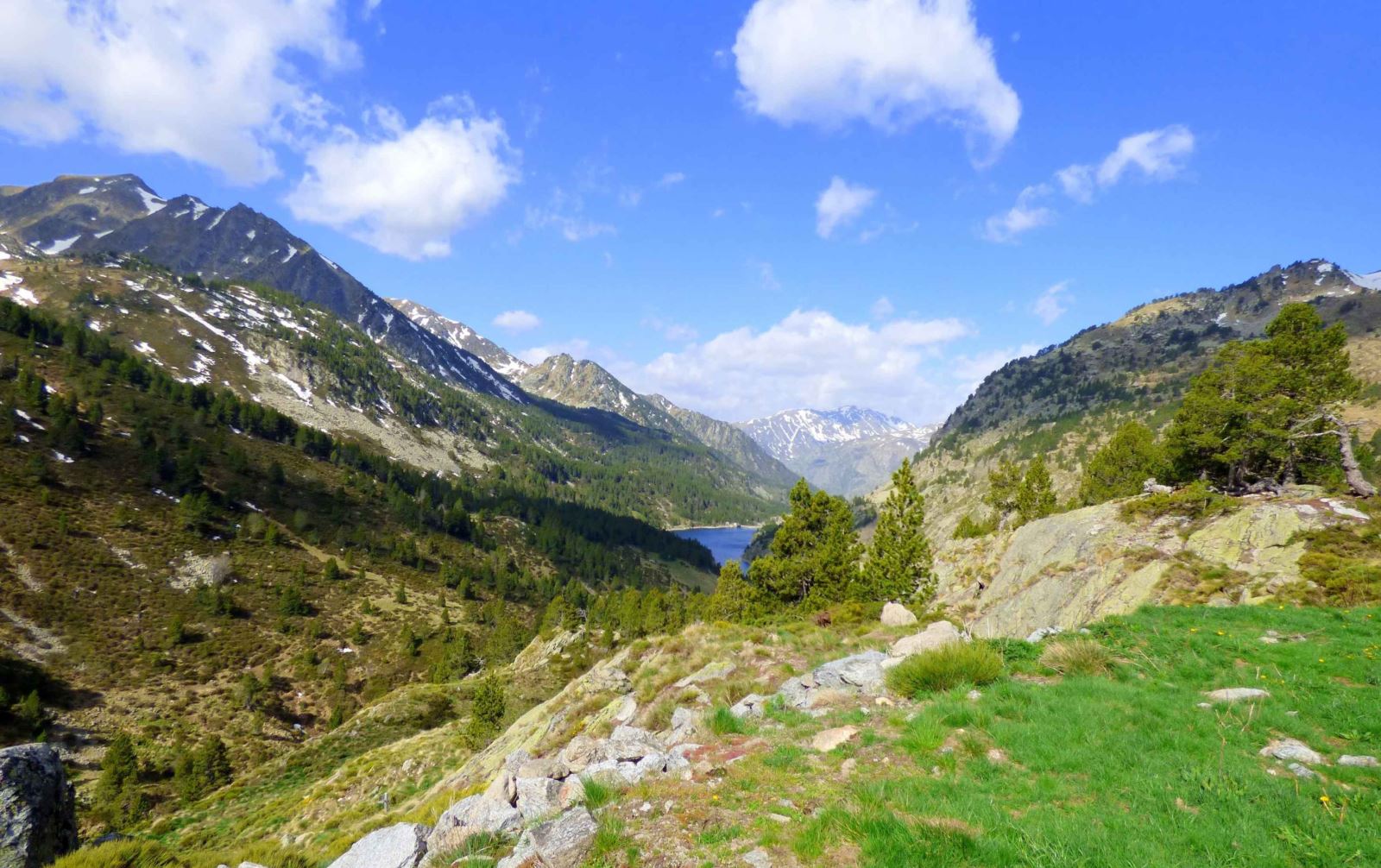 From
Bésines Refuge, the route crosses the Coume d’Anyell pass, leaving
Ariège for the Pyrénées-Orientales. Below the pass, you'll see the
Lanoux Lake, the largest lake in the French
Pyrenees, covering 1.71 km². After skirting the lake, the
path rises towards the Porteille de la Grave and descends onto the
Cerdagne plateau. Enjoy a lovely descent to the Pla and the Têt
River sources at 2,050 meters, flowing into the vast Bouillouses
Lake.
From
Bésines Refuge, the route crosses the Coume d’Anyell pass, leaving
Ariège for the Pyrénées-Orientales. Below the pass, you'll see the
Lanoux Lake, the largest lake in the French
Pyrenees, covering 1.71 km². After skirting the lake, the
path rises towards the Porteille de la Grave and descends onto the
Cerdagne plateau. Enjoy a lovely descent to the Pla and the Têt
River sources at 2,050 meters, flowing into the vast Bouillouses
Lake.
Distance: 16 km, duration: 5h45, ascent: +650 m, descent: -700
m
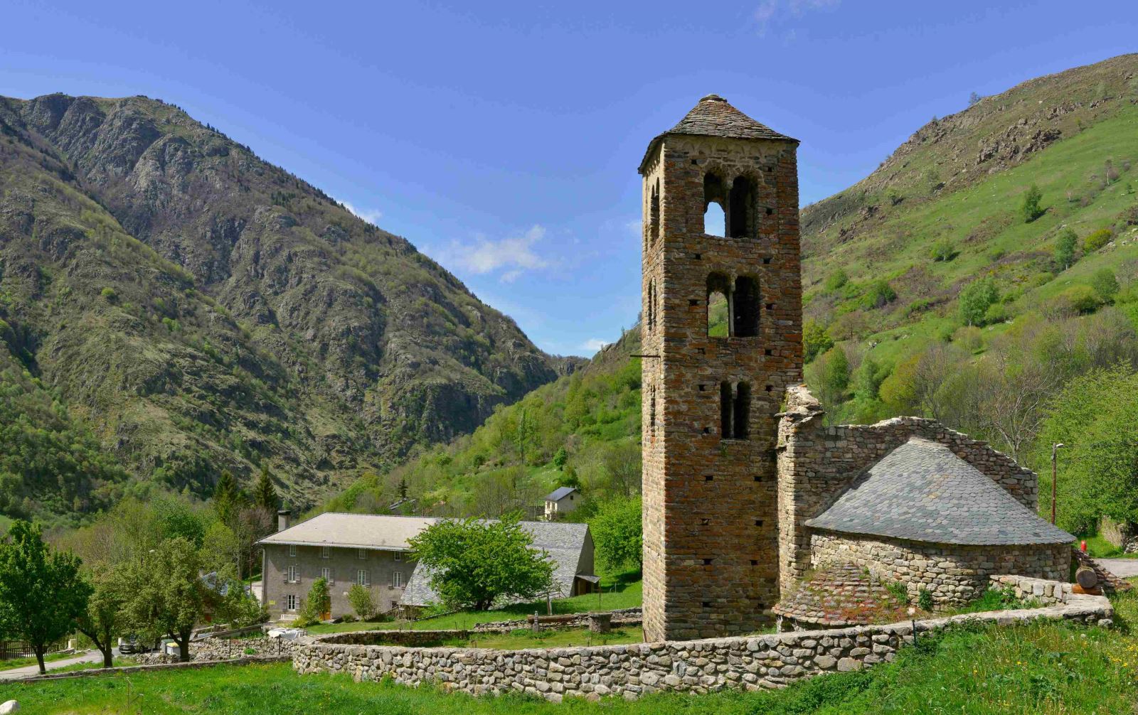
Day 3: From Bouillouses Lake to Planès
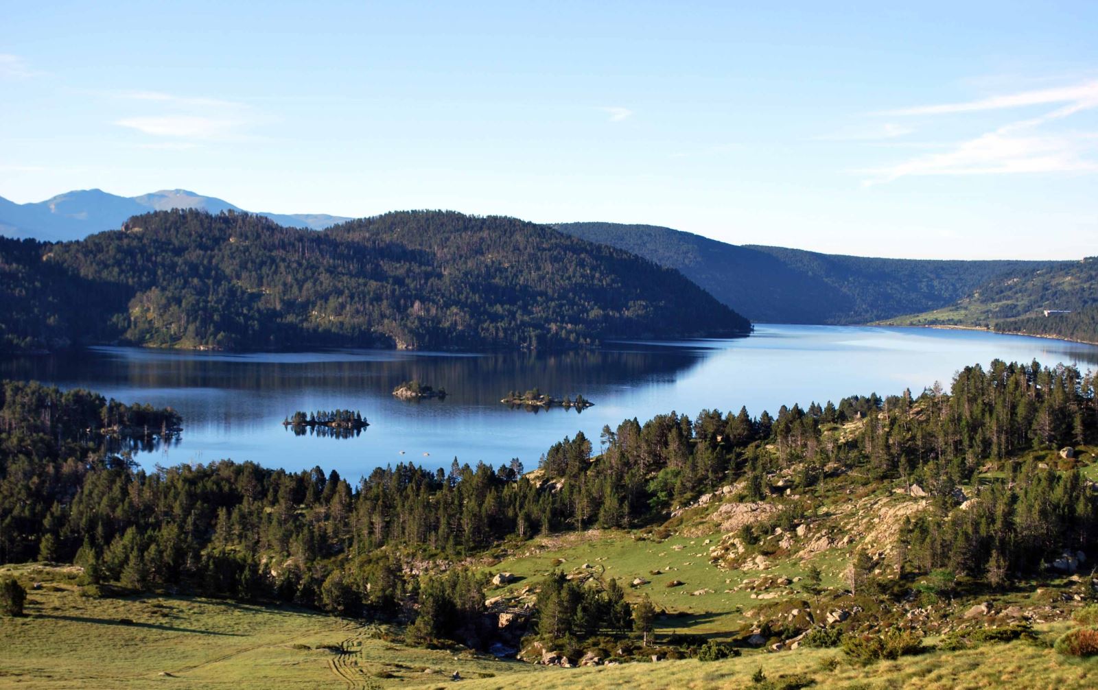 Starting
from Bouillouses, a paradise for hikers known as
the "Little Canada of the Pyrenees," this pleasant
transition stage weaves through plateaus, mountain lakes, and state
forests. After reaching Bolquère, near the famous Font Romeu
resort, you will cross the vast Cerdagne high
plateau, a landscape unique within the Pyrenees. Finally,
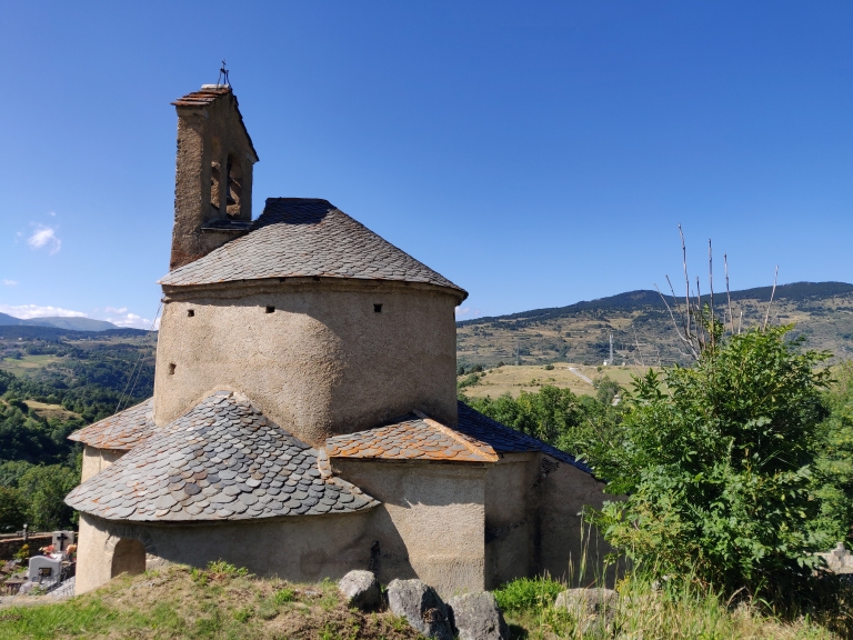
you will arrive at Planès, a beautiful village
with its Romanesque church, the only one in Europe with a
trefoil plan.
Starting
from Bouillouses, a paradise for hikers known as
the "Little Canada of the Pyrenees," this pleasant
transition stage weaves through plateaus, mountain lakes, and state
forests. After reaching Bolquère, near the famous Font Romeu
resort, you will cross the vast Cerdagne high
plateau, a landscape unique within the Pyrenees. Finally,
you will arrive at Planès, a beautiful village
with its Romanesque church, the only one in Europe with a
trefoil plan.
Distance: 20 km, duration: 6h, ascent: +250 m, descent: -750 m
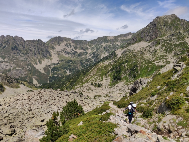
Day 4: From Planès to Carança Refuge
 The
topographic profile of this stage resembles a roller coaster, with
each descent followed by a pass or high plateau to cross. Today,
the ascent to Pla de Cédeilles offers a beautiful
walk through the Planès forest. The balcony
descent towards the Riberola valley is equally stunning. Then,
you'll climb to the broad Mitja pass (2,367 m), an
exceptional viewpoint towards the Cerdagne plateau,
Capcir, and the iconic Pic du Carlit. A final descent will lead you
to the Carança Refuge.
The
topographic profile of this stage resembles a roller coaster, with
each descent followed by a pass or high plateau to cross. Today,
the ascent to Pla de Cédeilles offers a beautiful
walk through the Planès forest. The balcony
descent towards the Riberola valley is equally stunning. Then,
you'll climb to the broad Mitja pass (2,367 m), an
exceptional viewpoint towards the Cerdagne plateau,
Capcir, and the iconic Pic du Carlit. A final descent will lead you
to the Carança Refuge.
Distance: 15 km, duration: 6h30, ascent: +1200 m, descent: -900
m
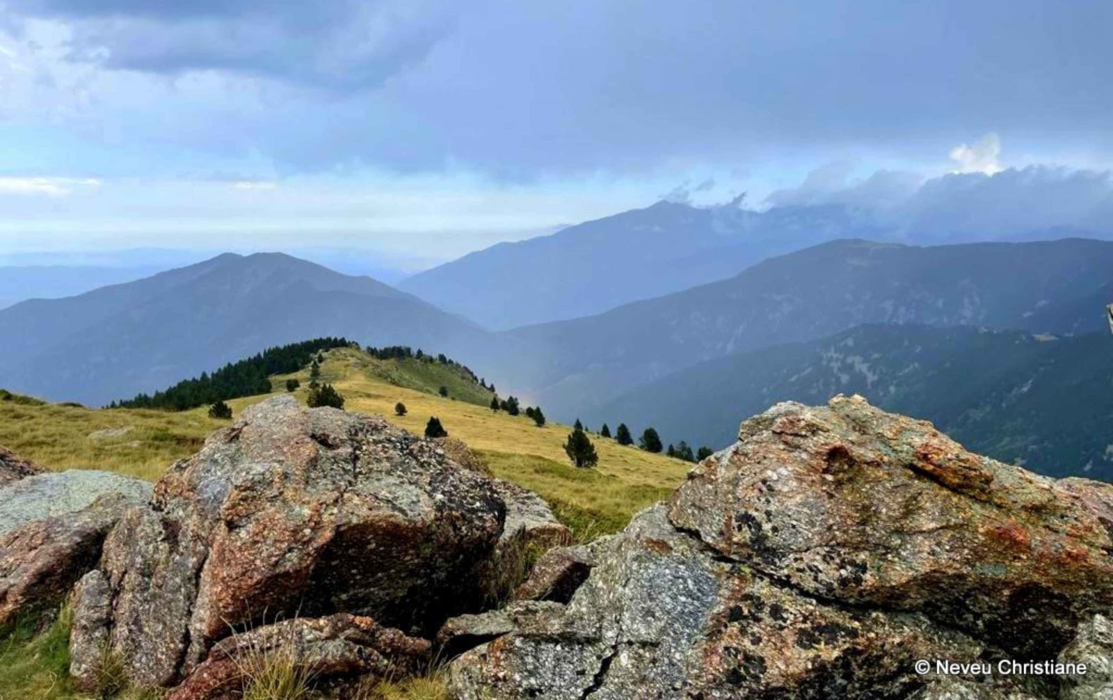
Day 5: From Carança Refuge to Mantet
 From
the charming Carança Refuge, a traverse followed by a wooded climb
leads to the Col del Pal, offering panoramic views, particularly of
the Canigou massif to the east. You then enter the
heart of the Mantet Nature Reserve, part of the
Catalan Nature Reserves network (7 in total). After descending into
the Alemany valley, you will climb again to reach the village of
Mantet, with its beautiful stone houses.
From
the charming Carança Refuge, a traverse followed by a wooded climb
leads to the Col del Pal, offering panoramic views, particularly of
the Canigou massif to the east. You then enter the
heart of the Mantet Nature Reserve, part of the
Catalan Nature Reserves network (7 in total). After descending into
the Alemany valley, you will climb again to reach the village of
Mantet, with its beautiful stone houses.
Distance: 10 km, duration: 4h45, ascent: +650 m, descent: -950
m
Day 6: From Mantet to Vernet-les-Bains
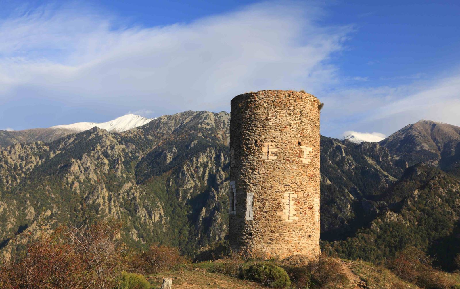 Today,
you will quickly reach the Mantet pass with stunning views of
the Py Nature Reserve. The Mediterranean ambiance
becomes increasingly pronounced, particularly in the vegetation. A
descent along the Campelles stream leads to the village of Py. From
there, a balcony path above the Rotja valley takes you to the Goa
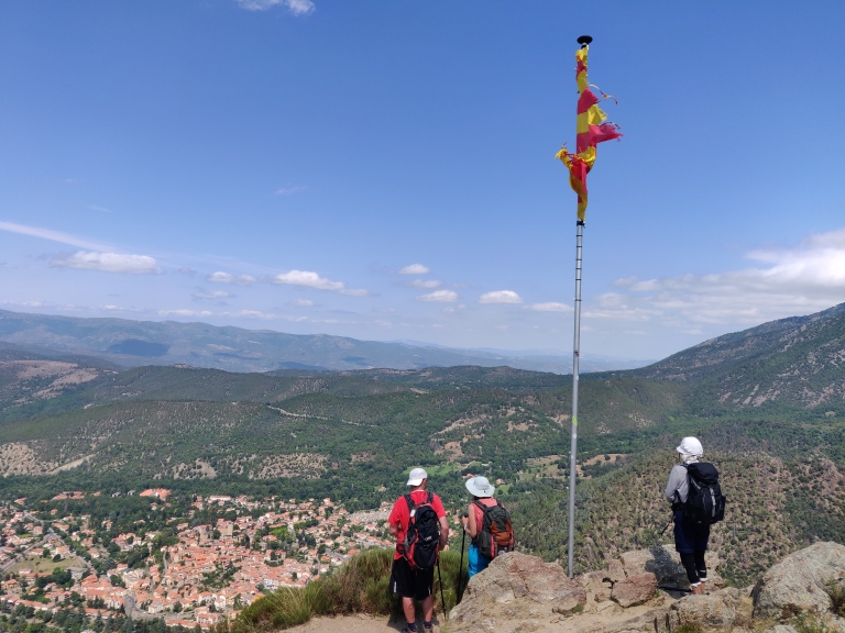
Tower, perched on a small natural platform offering splendid views
of the Canigou peak and the Haut Conflent region. A ridge path
followed by a forest descent will bring you to
Vernet-les-Bains.
Today,
you will quickly reach the Mantet pass with stunning views of
the Py Nature Reserve. The Mediterranean ambiance
becomes increasingly pronounced, particularly in the vegetation. A
descent along the Campelles stream leads to the village of Py. From
there, a balcony path above the Rotja valley takes you to the Goa
Tower, perched on a small natural platform offering splendid views
of the Canigou peak and the Haut Conflent region. A ridge path
followed by a forest descent will bring you to
Vernet-les-Bains.
Distance: 15 km, duration: 6h, ascent: +650 m, descent: -1550 m
Day 7: End of the Trip in Villefranche-de-Conflent
The itineraries have been planned based on the latest available information at the time of writing. Unforeseen circumstances may occur, and situations beyond our control could alter the schedule. On-site, our guides are the best judges and may adjust the route depending on the weather or if group safety requires it.
Welcome
On Day 1 at 9 AM in Mérens-les-Vals with your guide: briefing about the trip, distribution of your picnic for the day, and drop-off of your luggage with the carrier. The guide will contact you a few days before the trip to confirm the exact meeting location.
Dispersion
On Day 7 at Villefranche-de-Conflent train station after the transfer.
Level
Terrain Type
Hikes on well-marked trails, with varied terrain that is often rocky.
Level 3
For regular hikers in good physical condition with prior mountain hiking experience. Hikes average 6–7 hours per day with elevation gains of 700–1,000 meters, mostly on easy trails with occasional minor technical difficulties.
Note: The walking times provided are for reference only. They are average estimates based solely on active walking time, not including breaks. Depending on weather conditions, the hiking pace may vary, with elevation gains ranging from +300 m to +500 m per hour.
Accommodation
Full board (overnight stay + dinner + breakfast + picnic)
1 night in a hotel in a shared room on Day 6
1 night in a mountain inn in a shared dormitory on Day 2
2 nights in a gîte d’étape in a shared dormitory on Days 3 and 5
2 nights in a mountain refuge in a shared dormitory on Days 1 and 4
For nights in rooms: rooms for 2 to 3 people.
Meals
- Continental breakfast (tea, coffee, milk, bread, butter, jam)
- Evening meals often featuring local specialties, including a starter, main course, and dessert
- Picnics included
- Drinks not included
Luggage porterage
During the hike, you will carry only your personal day items, including your picnic and sufficient water. However, for overnight stays in mountain huts on Days 1 and 4, you will need to carry your personal items required for the night (sleeping bag liner, change of clothes, toiletries).
Please bring an easily transportable duffel bag for luggage transfers (see our equipment recommendations).
Your Luggage Service
Your luggage must be dropped off at the reception of your accommodation no later than 9:00 AM. It will be delivered to your next accommodation before 5:00 PM. Only one piece of luggage per person will be accepted. For logistical reasons, we ask that you limit the weight of your luggage to a maximum of 15 kg and avoid hard-shell suitcases: our logistics team and transport partners handle dozens of bags per day, often on staircases. The transporter may charge an additional fee at the end of the hike if the luggage is too heavy or too numerous.
Group
Group of 4 to 11 people.
Supervision
The hike is supervised by a certified mountain guide (BE AMM) specialized in the region.
 " This last part of the GR 10 is extraordinarily rich in scenery. Gone are the Central Pyrenees and the wild, unspoilt Ariège: the landscape opens up, and the terrain and culture change as you head towards the Canigou and the Mediterranean. The Catalan mountains offer a new facet of the Pyrenees’ diversity. "
Did you make this trip?
If you would like to submit your opinion, click on the button below:
Once your review is sent, it will be validated by our team before appearing on our site.
Pyrenean travel agency specializing in hikes in the Pyrenees, Basque country and the GR10.
")