Pyrenean travel agency specializing in your hikes and treks in the Pyrenees, the GR10 and more
BASQUE COUNTRY: Maison IPUTXAINIA, 64220 ASCARAT
ARIEGE: 20 chemin de la montagne, 09000 FOIX
+33 (0)5 34 14 51 50 - +33 (0)6 10 97 16 54
{pdfviewer file=https://respyrenees.com/media/attachments/2023/03/06/respyrenees_brochure_definitive_2023_bd.pdf}
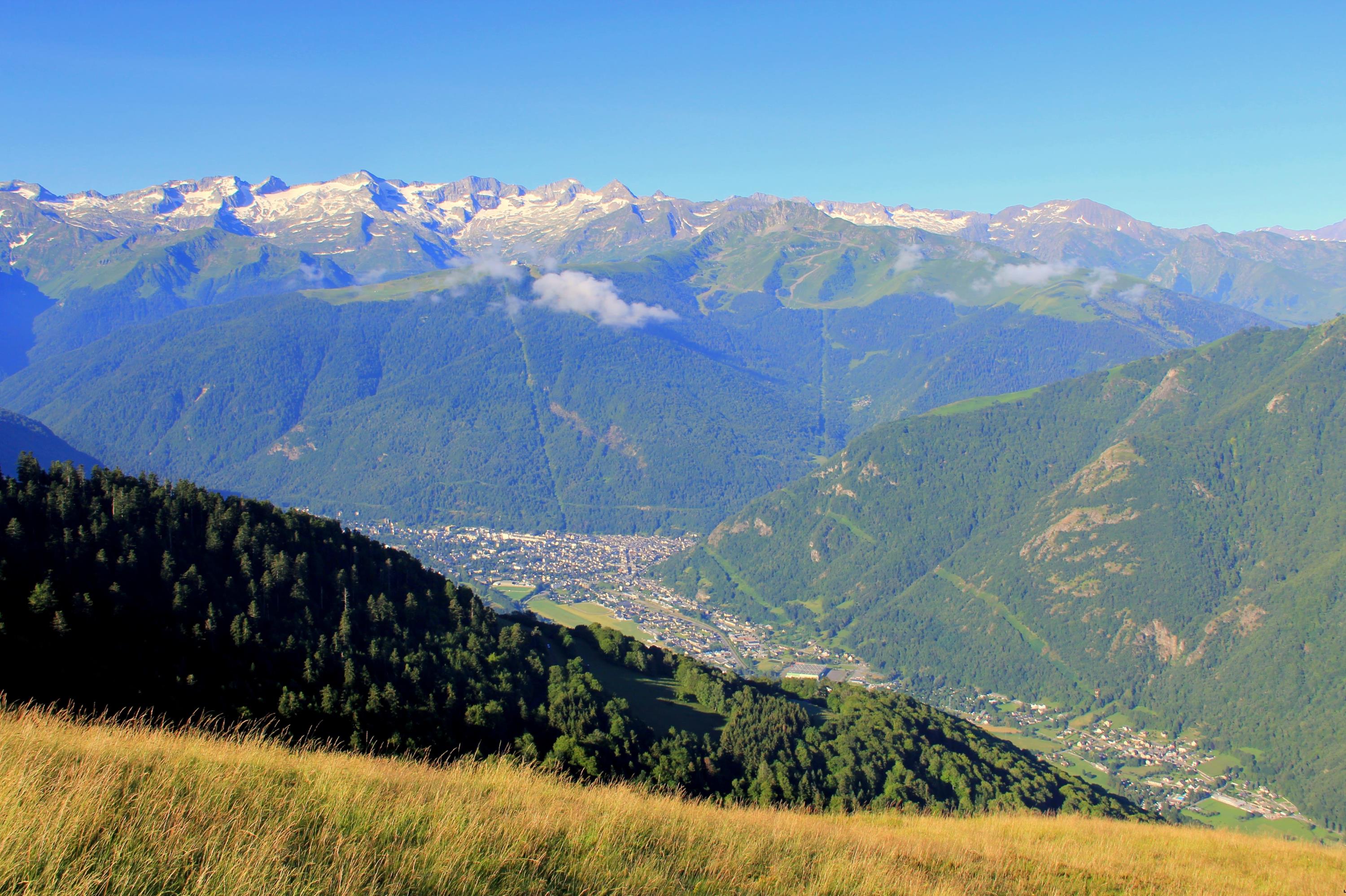

The itinerary for this 5th section of the Pyrenees crossing, with the famous GR10 as its guiding thread, gradually leaves the Central Pyrenees behind to enter the Ariège Pyrenees and the wild Couserans region. From Luchon, located at the southern tip of Haute-Garonne, a stunning first stage awaits you, offering panoramic views from the Bacanère ridge along the border. In the distance, the Maladeta range and its shimmering glaciers, crowned by Aneto (3,404m), the highest peak in the Pyrenees, will undoubtedly catch your eye.
After passing through the village of Fos, you will enter the Pyrenees Ariégeoises Natural Park and discover the beautiful site of Etang d'Araing, dominated by the Crabère peak. From there, the breathtaking panorama will give you a true sense of the vast wilderness and deep valleys you will explore in the coming days. The route then leads toward the Mont Valier Nature Reserve, home to the emblematic Mont Valier peak and a territory of the Pyrenean brown bear.
Finally, you will arrive at the thermal village of Aulus-les-Bains, but not before taking the time to admire the Ars waterfall-considered by many Pyrenean hikers to be the most beautiful waterfall in the Pyrenees.
Guaranteed departure with a minimum of 4 participants.
Price: €960 per person
Additional Costs:
- Return transfer from Saint-Girons to Bagnères-de-Luchon : €70 per person
- Extra night in Luchon and/or Aulus-les-Bains : Price upon request
- Full-board accommodation from the picnic on Day 1 to breakfast on Day 7
- Luggage transport between accommodations (except for 1 night in a refuge on Day 2)
- Transfers mentioned in the program
- Guidance by a certified mountain leader (BE AMM) specialized in the region
- Travel insurance
- Transfers not included in the program
- Entrance fees for visits
- €15 booking fee
- Drinks
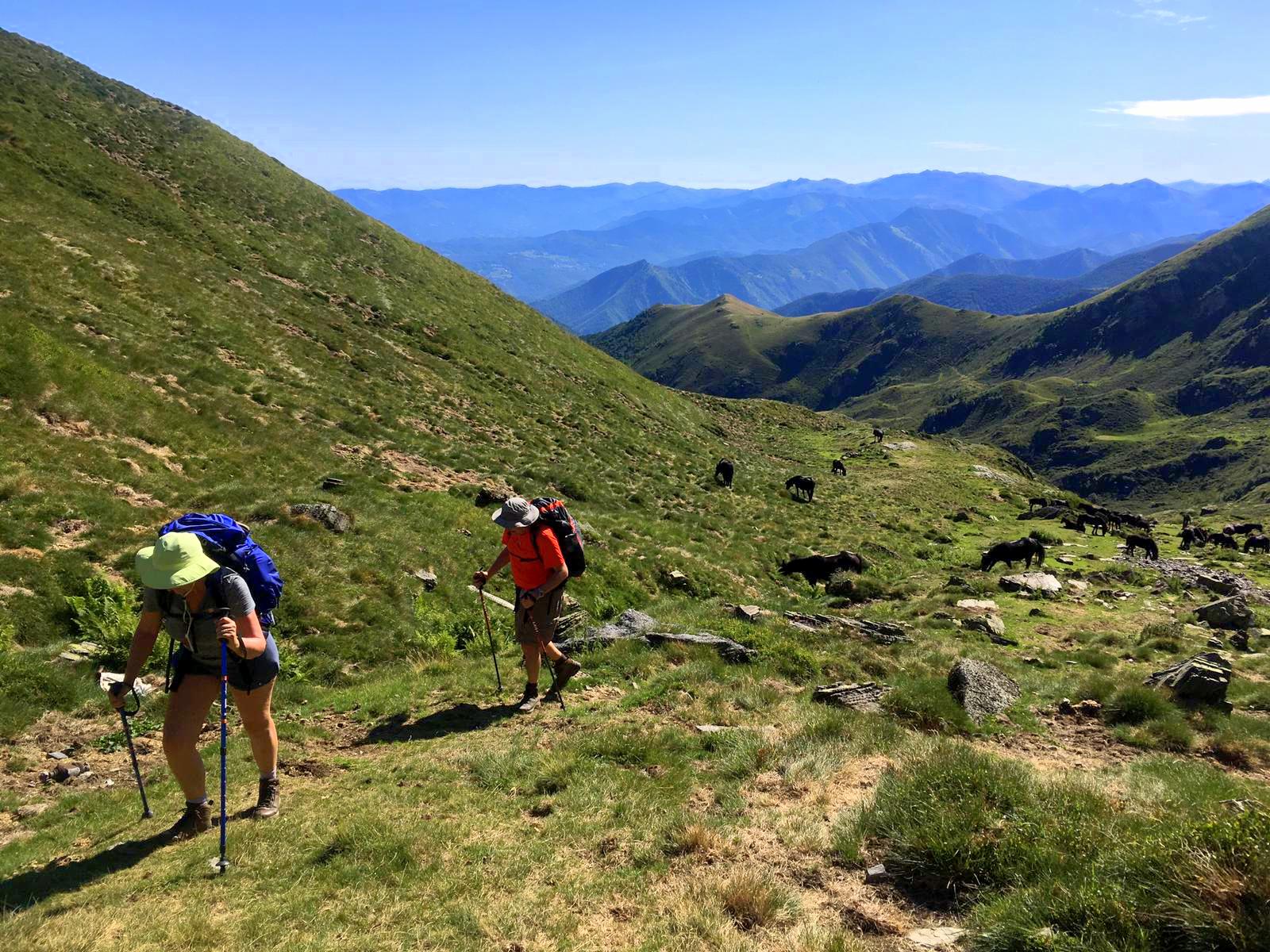
Day 1: From Artigue to Fos
 Meet
your guide at 8 AM in Luchon for a transfer to the village of
Artigue, the starting point of the hike (15 min). From Artigue,
you will begin an ascent to the Col de Peyrahitte. Shortly after
the pass, a stunning ridge trail reaching the Pic de
Bacanère (2193m) offers a fantastic panoramic view
stretching from the peaks of Ariège to those of the
Hautes-Pyrénées, passing through the Luchonnais, Aneto (the
highest peak in the Pyrenees), the
Encantats, and many more. This breathtaking
panorama will accompany you along a pleasant 3km ridge walk
punctuated by small scenic summits. The descent then takes you from
shepherds' huts through a forested area to reach the village of
Fos.
Meet
your guide at 8 AM in Luchon for a transfer to the village of
Artigue, the starting point of the hike (15 min). From Artigue,
you will begin an ascent to the Col de Peyrahitte. Shortly after
the pass, a stunning ridge trail reaching the Pic de
Bacanère (2193m) offers a fantastic panoramic view
stretching from the peaks of Ariège to those of the
Hautes-Pyrénées, passing through the Luchonnais, Aneto (the
highest peak in the Pyrenees), the
Encantats, and many more. This breathtaking
panorama will accompany you along a pleasant 3km ridge walk
punctuated by small scenic summits. The descent then takes you from
shepherds' huts through a forested area to reach the village of
Fos.
Distance: 20km, duration:. 7h45, ascent: +1000m, descent:
-1650m
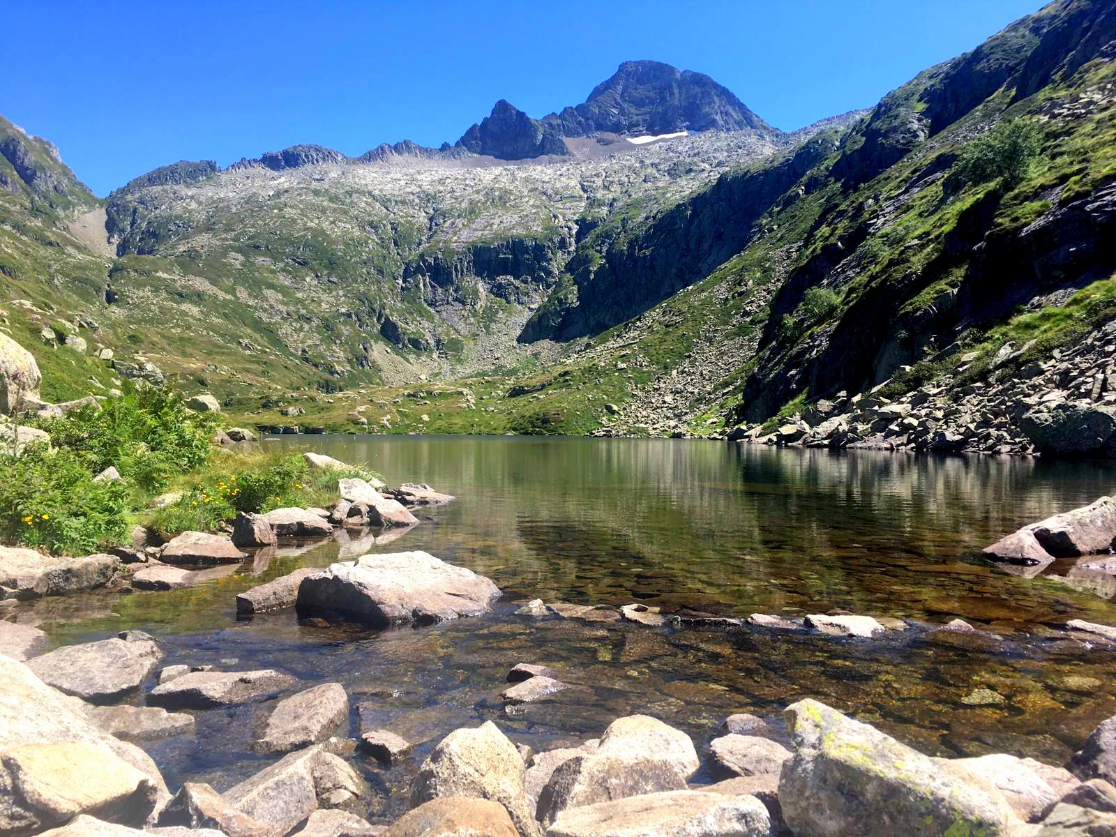
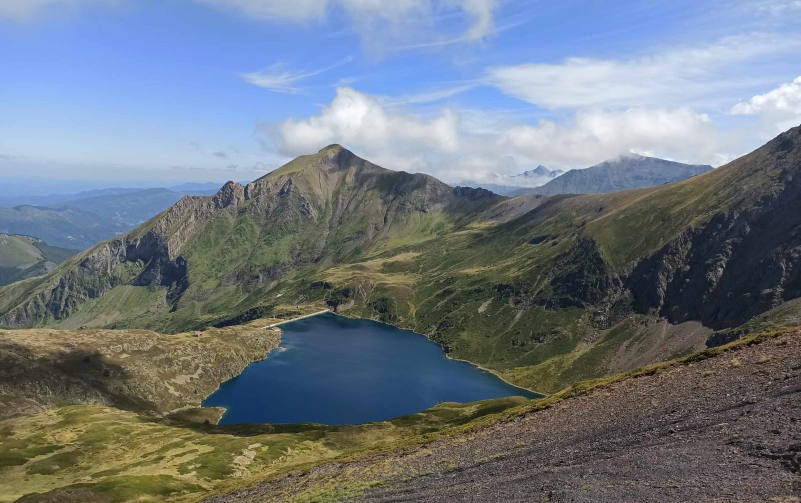
Day 2: From Fos to Etang d'Araing
 From
the village of Fos in the Comminges region, a long ascent takes you
over the Col d’Auéran (2176m), marking your entrance into Ariège
and the Couserans region. From the pass, you will catch sight of
the beautiful setting of the Araing Refuge, your destination for
the day, located near the lake of the same name beneath the cliffs
of Crabère Peak. The landscapes traversed already hint at the vast,
wild expanses characteristic of this part of the Pyrenees.
From
the village of Fos in the Comminges region, a long ascent takes you
over the Col d’Auéran (2176m), marking your entrance into Ariège
and the Couserans region. From the pass, you will catch sight of
the beautiful setting of the Araing Refuge, your destination for
the day, located near the lake of the same name beneath the cliffs
of Crabère Peak. The landscapes traversed already hint at the vast,
wild expanses characteristic of this part of the Pyrenees.
Distance: 16km, duration: 7h, ascent: +1700m, descent: -300m
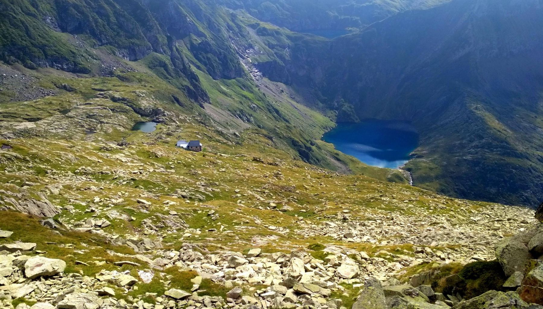
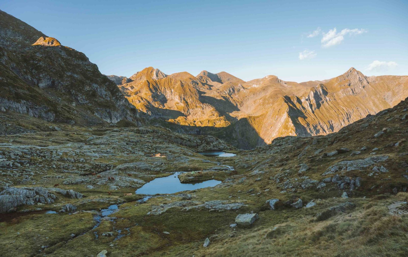
Day 3: From Etang d'Araing to Eylie
 Today's
route connects the Araing Refuge to the small village of Eylie d’en
Haut, at the gateway to Haute-Ariège and the untamed Couserans.
This shorter stage allows for recovery from previous days and
provides an opportunity to prepare for the long hike ahead. If the
group is up for it, your guide may offer an optional morning
exploration of hidden scenic spots around the Araing Lake
and Refuge.
Today's
route connects the Araing Refuge to the small village of Eylie d’en
Haut, at the gateway to Haute-Ariège and the untamed Couserans.
This shorter stage allows for recovery from previous days and
provides an opportunity to prepare for the long hike ahead. If the
group is up for it, your guide may offer an optional morning
exploration of hidden scenic spots around the Araing Lake
and Refuge.
Distance: 8km, duration: 4h15, ascent: +400m, descent: -1350m
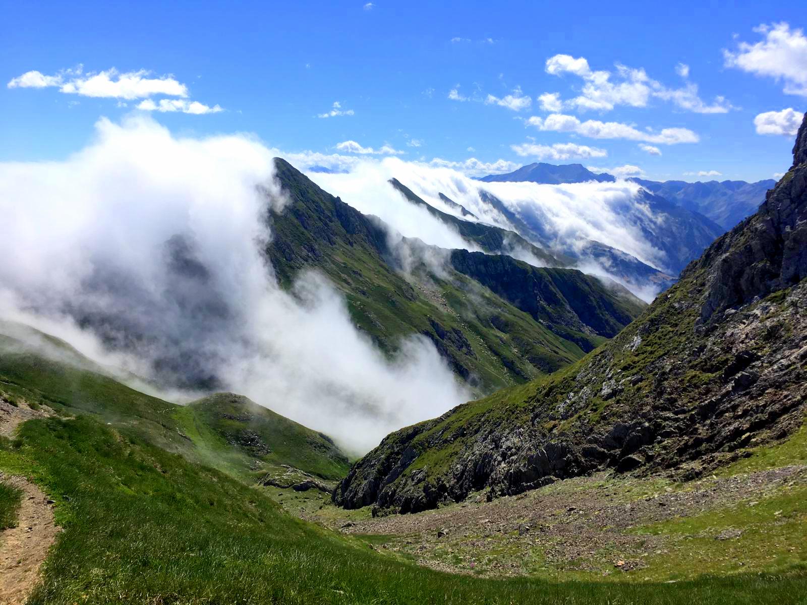
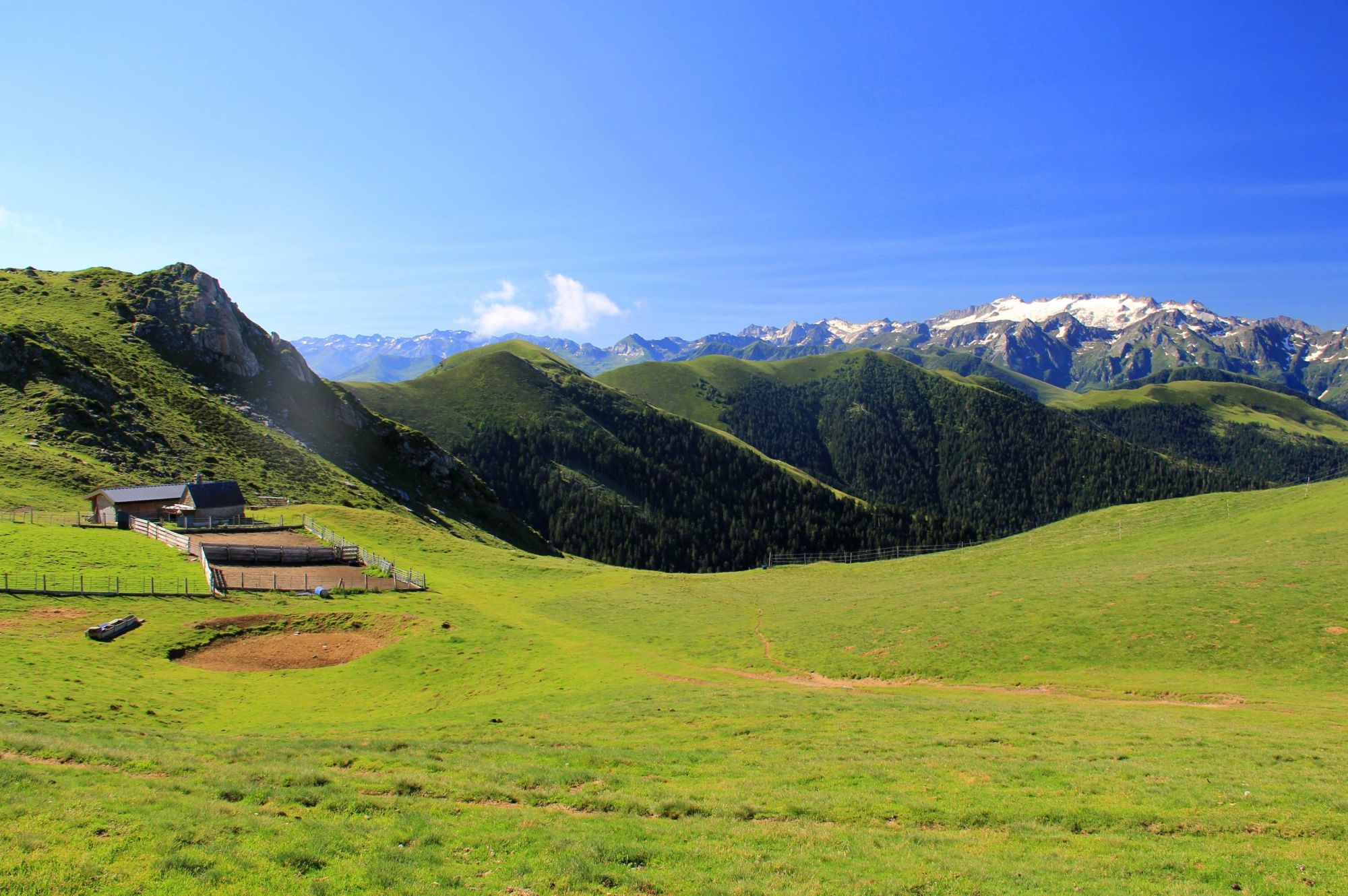
Day 4: From Eylie to Maison du Valier
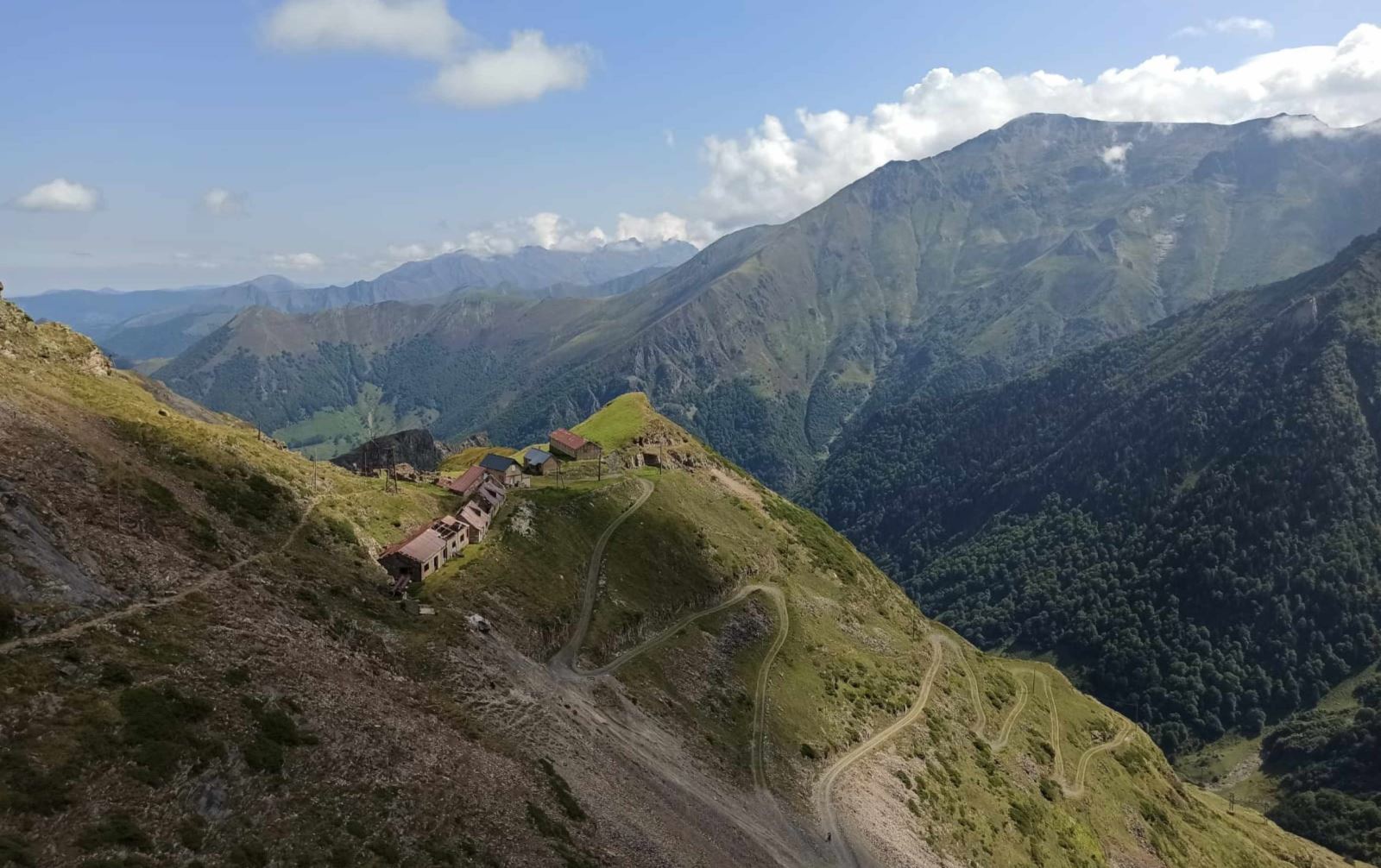 Departing
from Eylie, this demanding stage in the heart of the
Couserans region takes you through the wild landscapes
typical of this part of the Pyrenees: beech forests, mountain
pastures, and shepherds’ huts. Crossing the Cols de l’Arech and
Clot du Lac, you will enjoy stunning views of the surrounding
mountains rising above deep valleys. You will then reach
the Pla de la Lau and the Maison du Valier.
Departing
from Eylie, this demanding stage in the heart of the
Couserans region takes you through the wild landscapes
typical of this part of the Pyrenees: beech forests, mountain
pastures, and shepherds’ huts. Crossing the Cols de l’Arech and
Clot du Lac, you will enjoy stunning views of the surrounding
mountains rising above deep valleys. You will then reach
the Pla de la Lau and the Maison du Valier.
Distance: 18km, duration: 8h30, ascent: +1550m, descent: -1600m
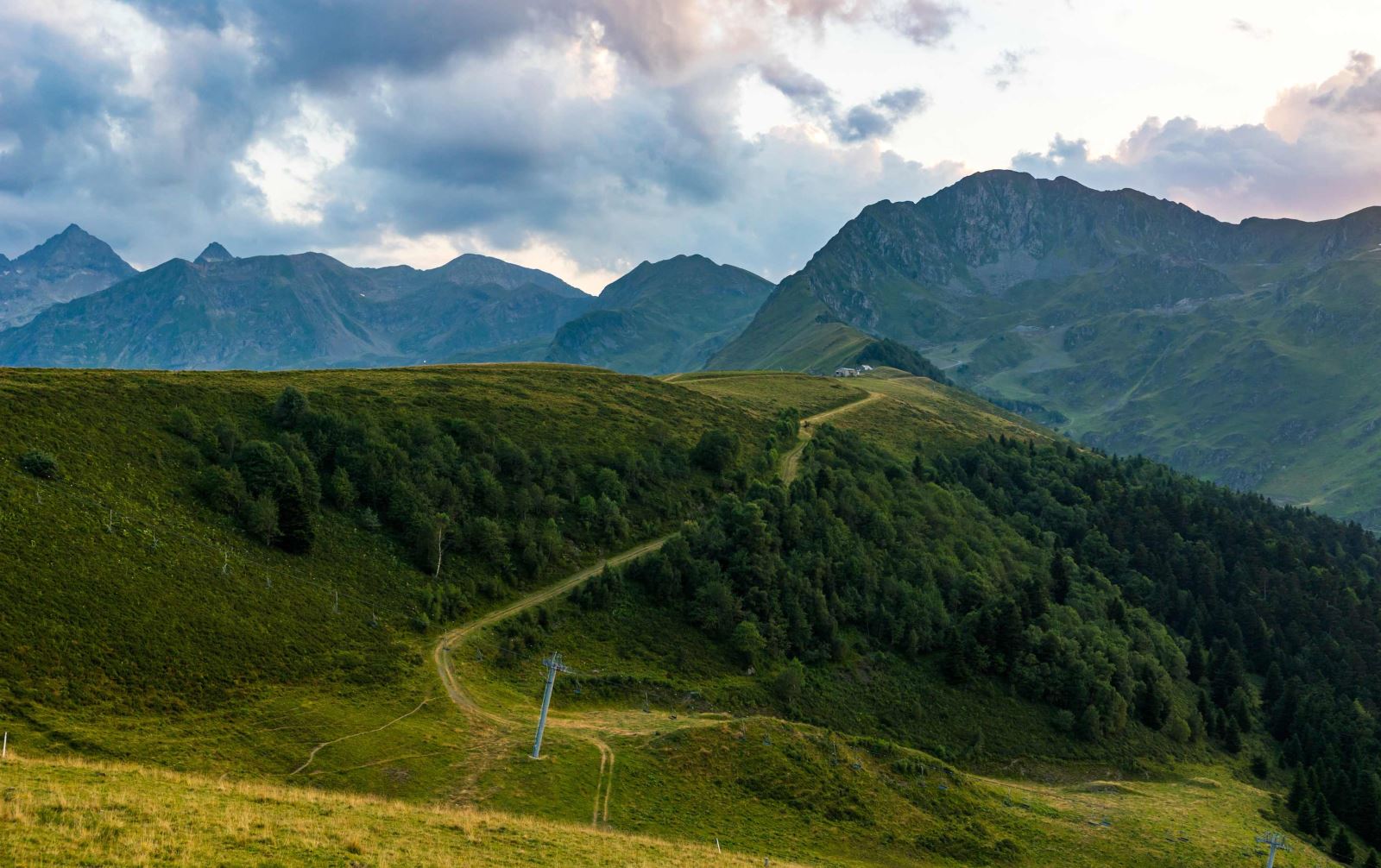
Day 5: From Maison du Valier to Col de la Core
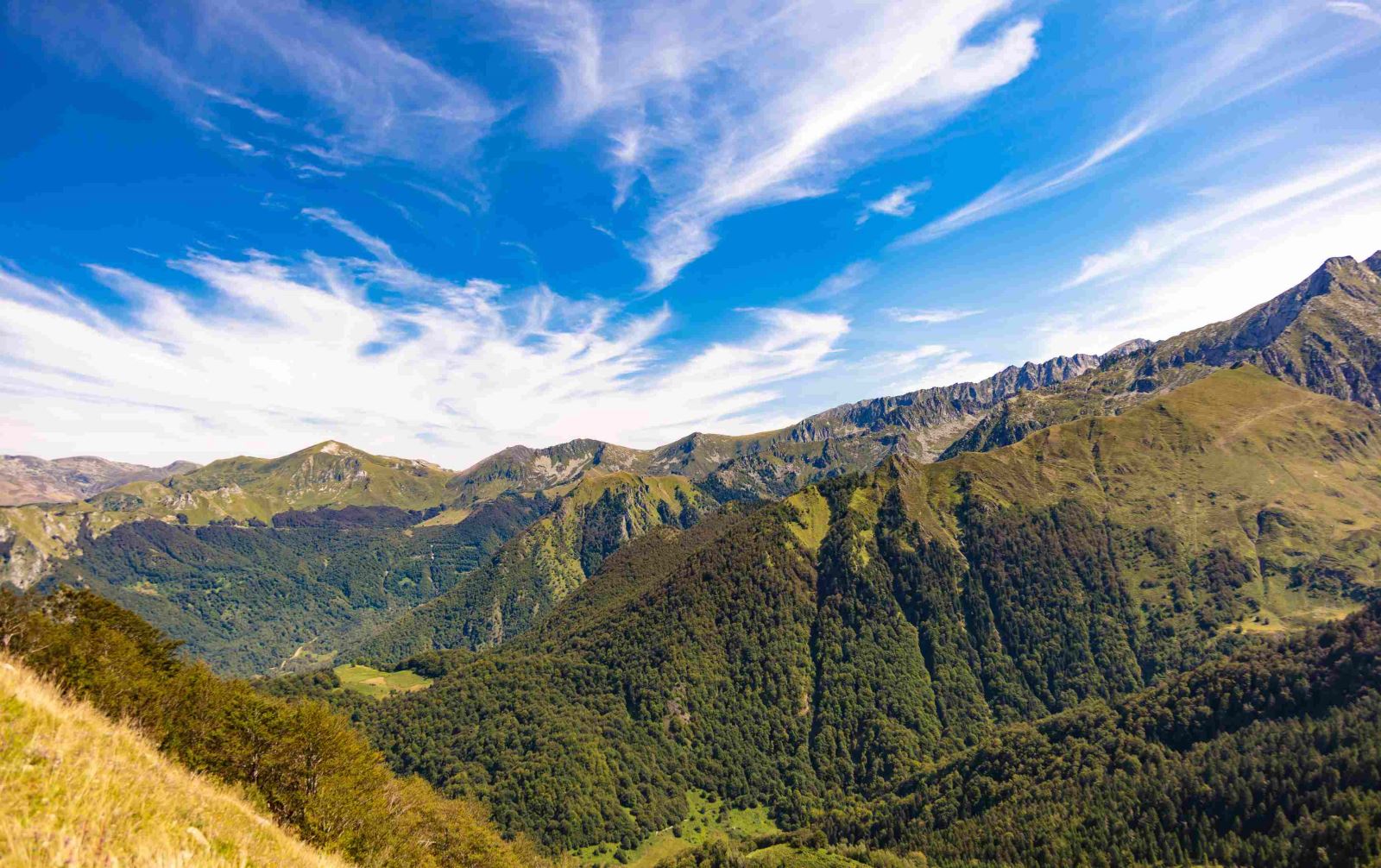 A
day of hiking along scenic balcony trails between the high
mountains and the foothills of the Couserans. You will leave behind
the Mont Valier massif, the emblematic peak of the
Couserans, while enjoying superb views of this summit and
other high peaks in the area. The charming Etang
d’Ayes will add beauty to your route before reaching the
Col de la Core. At the end of the hike, a transfer from Col de la
Core to St Lizier d’Ustou avoids a section of the GR10 with no
accommodation.
A
day of hiking along scenic balcony trails between the high
mountains and the foothills of the Couserans. You will leave behind
the Mont Valier massif, the emblematic peak of the
Couserans, while enjoying superb views of this summit and
other high peaks in the area. The charming Etang
d’Ayes will add beauty to your route before reaching the
Col de la Core. At the end of the hike, a transfer from Col de la
Core to St Lizier d’Ustou avoids a section of the GR10 with no
accommodation.
Distance: 13.5km, duration: 6h30, ascent: +1250m, descent:
-800m
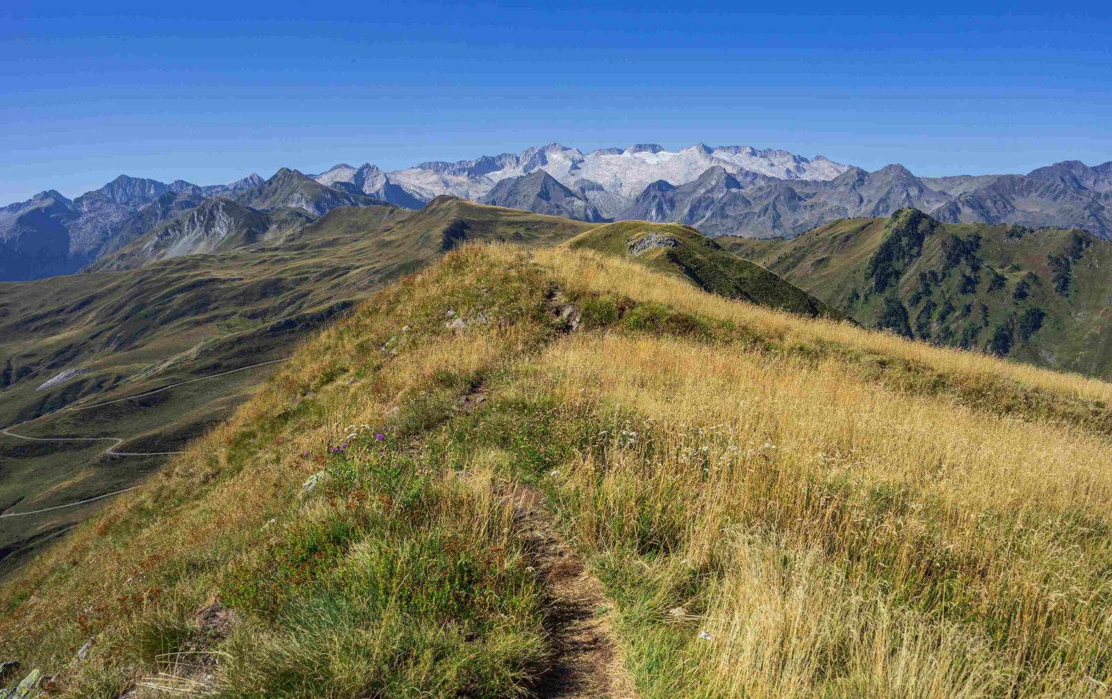
Day 6: From St Lizier d'Ustou to Aulus-les-Bains
 This
stage marks the transition from the Couserans to Haute-Ariège.
Departing from the picturesque hamlet of St Lizier d’Ustou, nestled
in a lush valley, you will ascend to the Col
d’Escots. From the pass, a beautiful view opens up over
the last high border peaks of the Couserans. You will then descend
toward the thermal village of Aulus-les-Bains via
the Cirque Casérien and the scenic Fouillet waterfall. If the group
is feeling strong, a longer detour via the Guzet Lake and
the Ars waterfall will allow you to admire one of
the most beautiful waterfalls in the Pyrenees.
This
stage marks the transition from the Couserans to Haute-Ariège.
Departing from the picturesque hamlet of St Lizier d’Ustou, nestled
in a lush valley, you will ascend to the Col
d’Escots. From the pass, a beautiful view opens up over
the last high border peaks of the Couserans. You will then descend
toward the thermal village of Aulus-les-Bains via
the Cirque Casérien and the scenic Fouillet waterfall. If the group
is feeling strong, a longer detour via the Guzet Lake and
the Ars waterfall will allow you to admire one of
the most beautiful waterfalls in the Pyrenees.
Distance: 15km, Duration: 6h30, Ascent: +1100m, Descent: -1100m
Day 7: End of the trip in Saint-Girons
After breakfast, transfer (35 min) to Saint-Girons, marking the end of the trip. Here, you can visit the Saint-Girons market, ranked among the most beautiful markets in France. Set along the Salat River, this lively market offers a wide variety of local products, including vegetables, cured meats, poultry, bread, millas, cheeses, honey, jams, pastries, and other farm-fresh goods.
This itinerary was created based on the most recent information available at the time of writing. Unexpected circumstances may arise, and situations beyond our control could alter the schedule. On-site, our guides are the best judges of conditions and may modify the route based on weather conditions or group safety needs.
Welcome
On Day 1 at 8 AM in Bagnères-de-Luchon with your guide. You will receive a briefing on the trip, your packed lunch for the day, and a transfer to the village of Artigue, the starting point of the hike. Your guide will contact you a few days before the trip to confirm the exact meeting location.
Dispersion
On Day 7 in Saint-Girons after the transfer from Aulus-les-Bains.
Level
Terrain Type
Hiking on well-maintained trails, with varied but often rocky terrain.
Level: 4
For experienced hikers in good physical condition who already have solid mountain trekking experience. Hikes average 7 to 8 hours per day, with elevation gains of 1,000 to 1,300 meters. Trails are generally accessible but may include rough terrain (scree, boulder fields) and occasionally unmarked paths.
Note: The walking times provided are estimates based on average pace and do not include breaks. Depending on weather conditions, the ascent rate may vary between +300m to +500m per hour.
Accommodation
Full board (overnight stay + dinner + breakfast + picnic)
5 nights in gîte-style accommodations with shared dormitories (Days 1, 3, 4, 5, and 6)
1 night in a mountain refuge with a shared dormitory (Day 2)
Private Room Option: Rooms for 2 to 3 people available.
Meals
- Breakfast: Continental style (tea, coffee, milk, bread, butter, jam).
- Dinner: Typically features local specialties, including a starter, main course, and dessert.
- Picnics included.
- Drinks not included.
Luggage porterage
During the hike, you will only need to carry your personal belongings for the day, including your picnic and a sufficient water supply.
Exception: On Day 2, you will need to carry your overnight essentials (sleeping bag liner, change of clothes, toiletries) for the night in the refuge. A transportable follow-up bag is recommended (see our gear advice).
Group
Group of 4 to 11 people.
Supervision
The hike is led by a certified mountain leader (BE AMM) specializing in the region.
")